*Originally published in 2020
Updated on August 29, 2024:
Isolated geologic wonder is a perfect stroll for nature and geology lovers.
Thar she blows! Well, sort of. Colorado's Geyser Spring isn't Old Faithful, but it does erupt (more of a boil) gently every 30 to 40 minutes. It is located along a beautiful, fairly easy high-country trail that won't disappoint.
Located in the San Juan National Forest, accessible from a trailhead a few miles south of Dunton, this geyser is part of a network of hot springs activity in the area. The small pool at the end of the Geyser Springs Trail stays at a comfortable 82.4 degrees Fahrenheit and will roil over the sides and into a nearby creek for about 15 minutes after every eruption. It's a beautiful turquoise blue so that you won't miss it.
The geyser emits hydrogen sulfide, so you will catch a whiff of a sulfur smell in the vicinity. The hike up is also dotted with sulfur vents, so don't be surprised if you smell it on your way, but it's reported that it isn't overwhelming. According to the USFS, there are a few precautions to take when viewing the geyser.
"Periodic eruptions of carbon dioxide and hydrogen sulfide gas displace oxygen near the water’s surface. Swimming or bathing in the geyser is NOT recommended, this exposes one to these gases and could cause a loss of consciousness, and potentially death. If you should feel light-headed or nauseous while viewing the geyser, you should leave the area immediately."
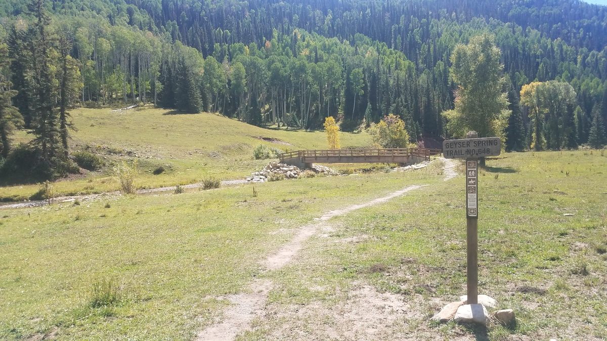
The Hike
Rated as easy to moderate, you will take the Geyser Spring Trail from the trailhead over the Dolores River via a footbridge and hike in about 1.5 miles (a three-mile, out-and-back hike). The trail will gain about 500 feet in elevation, with gentle switchbacks to help you take on any inclines. The trail starts at 8,600 ft. in elevation, so be sure to take your time and enjoy that wonderful Colorado mountain air.
As it is tucked away in the backcountry, chances are you won't run into too many people along the trail. You will see the San Miguels' peaks, mountain flora and fauna, and old mining claims. Stay on the trail for your safety, as old mining sites can be pretty dangerous. There's a lot you don't see going on under the surface in these areas.
"Evidence of mining activity is apparent in the area. Please use caution, stay out of mining areas, and pay close attention to cautionary signs posted in the area," cautions the USFS.
While you should avoid actually getting in the geyser (due to the gas and all), if you want to enjoy the results of our volcanic history in the area, Dunton Hot Springs is just a couple of miles from the trailhead! You can soak and soothe your cares away after a day of hiking.
Courtesy of Atlas Obscura
Directions to the Trailhead
From Dolores, head east on Highway 145 for 12 miles to the junction of NFSR (National Forest Service Road) #535. Turn left and travel 23.3 miles. The parking area is on the right side of NFSR #535. The trailhead is 2.2 miles south of the town of Dunton.
