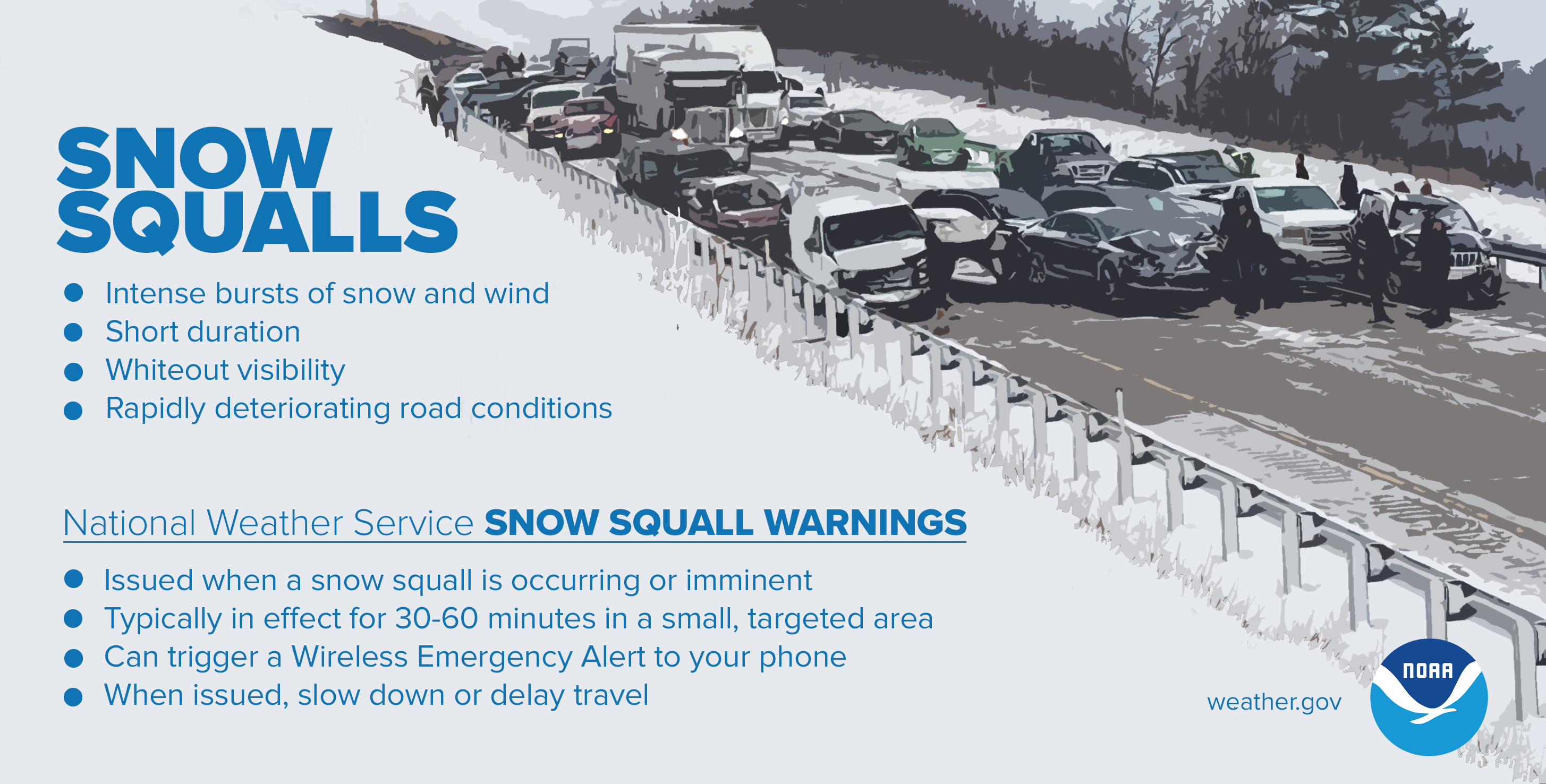
The Gazette offers audio versions of articles using Instaread. Some words may be mispronounced. Eastern Iowa is poised to see its first snowfall of the season Wednesday afternoon, into the evening. Rich Kinney, warning coordination meteorologist for the National Weather Service’s Quad Cities bureau said the weather service is predicting “light dustings” of snow, with about half an inch predicted for the Cedar Rapids area. He added that any snow likely will remain only on elevated surfaces, since the temperature of the ground and pavement will melt much of the falling snow. The high temperature Wednesday in Cedar Rapids is forecast to be around 42 degrees. Despite the light snowfall, Kinney said there is concern for “snow squalls” later in the day, as the area will see gusts of wind between 25 and 30 mph. These snow squalls “can reduce visibility to near zero very quickly,” Kinney said. Snow squalls are a winter weather hazard that can move in and out quickly, sometimes lasting less than an hour, creating sudden whiteout conditions. They occur when there is heavy snowfall and strong, gusty winds that leads to a quick reduction in visibility . The squalls can develop even when there isn’t a large-scale winter storm in progress.
CONTINUE READING
